Selecting the right land is a critical first step in establishing a successful agricultural project. Land boundaries, terrain, accessibility and the surrounding geographic context all influence how a site can be evaluated and developed.
Apex Four Ventures undertook a geospatial site mapping and land suitability assessment project for an international company seeking suitable land for agricultural development in Zimbabwe.
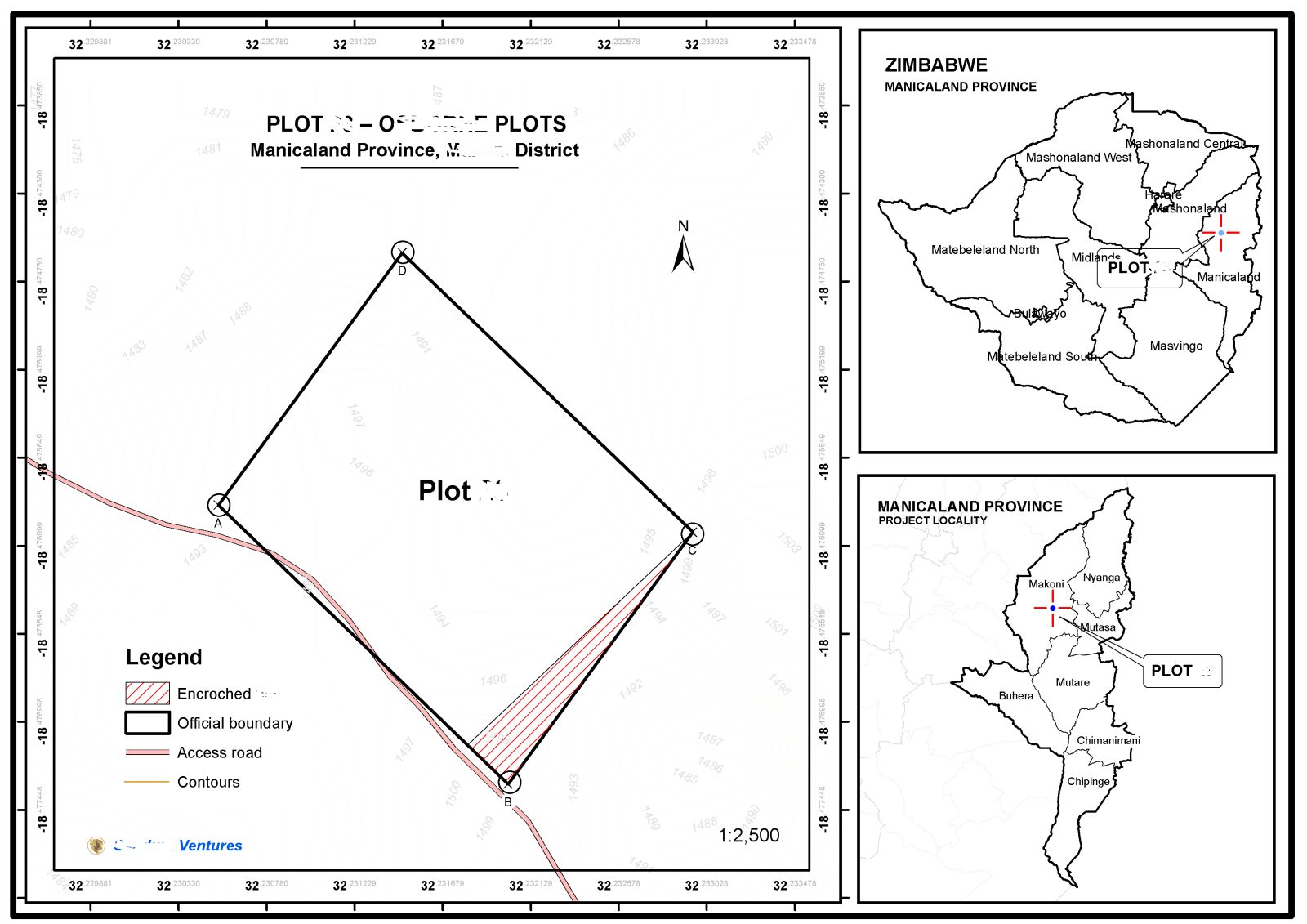
The project brought together regional location mapping and detailed property-level cartography to provide a clearer understanding of the proposed site. The resulting map presents the property's boundaries, access road, surrounding terrain and relevant spatial features, supported by locality maps showing its position within Zimbabwe and Manicaland Province.
Contour information provides additional context for understanding variations in terrain, while the mapped boundary and identified encroachment area help highlight spatial considerations that may require further investigation before development.
By consolidating these elements into a structured site assessment map, the project supported a more informed evaluation of the land and provided a practical spatial reference for agricultural planning and investment decision-making.
Delivering value through geospatial intelligence
This project demonstrates how professional mapping can transform land information into a practical decision-support resource. For organisations planning agricultural investments, a well-documented site assessment can help identify potential constraints, improve understanding of a property's characteristics and guide the next stages of land evaluation.
Apex Four Ventures provides geospatial mapping and land assessment support to help clients make more informed decisions about where and how to develop their projects.
Call to action
Looking for land for agricultural development? Apex Four Ventures can support your project with professional site mapping, geospatial assessment and land suitability analysis to help you evaluate potential sites and plan with greater confidence.



 GIS Experts Zimbabwe