A well-prepared mining site plan is essential for clearly communicating the location, extent and organisation of mining activities. Apex Four Ventures prepared this Siting of Works Plan to support mining operations and the preparation of documentation required by the Ministry of Mines.
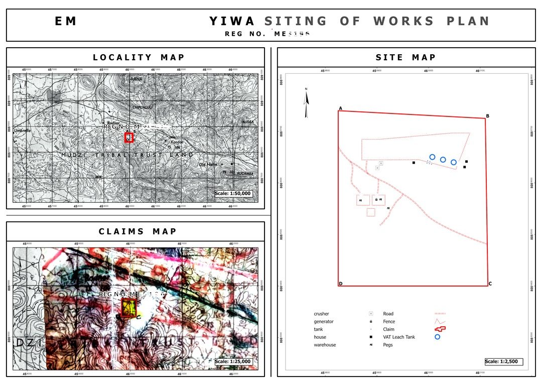
The plan combines three complementary mapping components: a locality map establishing the site's geographical context, a claims map showing its position in relation to the surrounding mining claim area, and a detailed site map illustrating the claim boundary, access roads and mapped operational infrastructure.
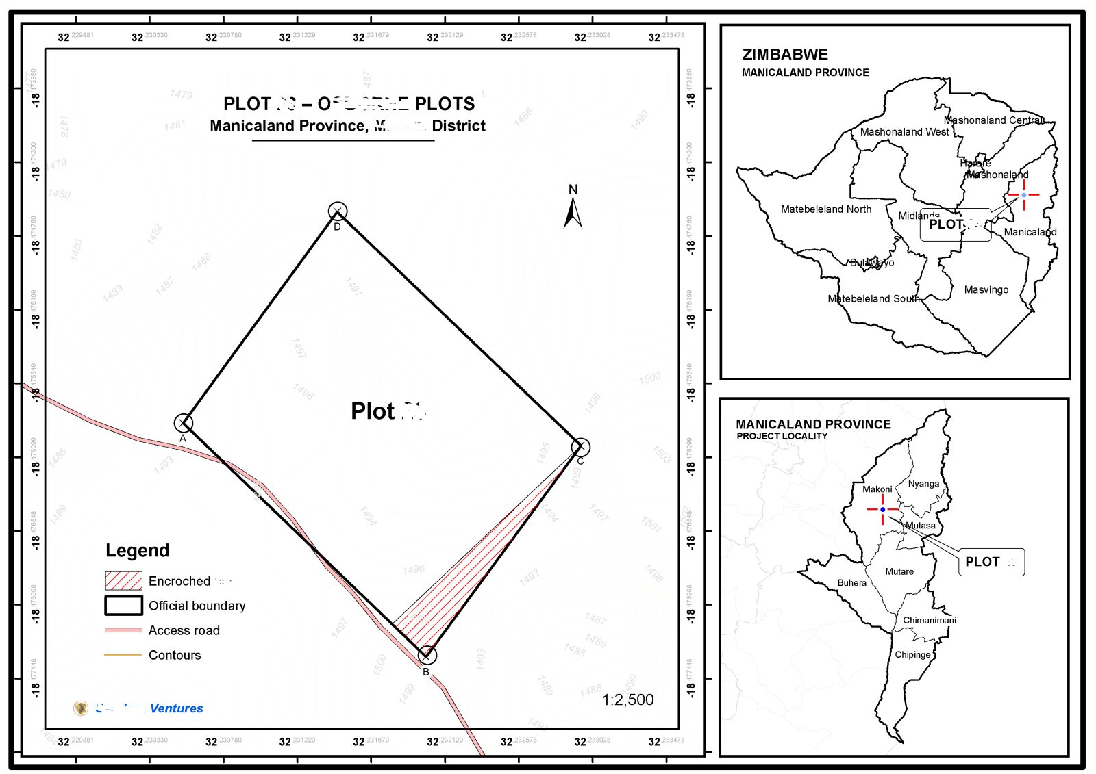
Developed for a site covering approximately 10 hectares, the cartographic layout brings essential spatial information together in one coordinated drawing. Clearly defined boundaries, coordinate references, map scales and a detailed legend help communicate the relationship between the mining site and its operational features.
By translating site information into a structured and readable plan, this project demonstrates Apex Four Ventures' capability in mining cartography, spatial documentation and the preparation of technical maps for mining-related workflows.
Planning and compliance note: The plan is intended to support the relevant mining documentation process. Formal acceptance or regulatory approval depends on the applicable requirements and the responsible authority's assessment.
Call to action
Planning a mining operation or preparing mining documentation? Contact Apex Four Ventures for professional mining mapping, site-plan preparation and geospatial support tailored to your project.




 GIS Experts Zimbabwe