AI & satelliteActive
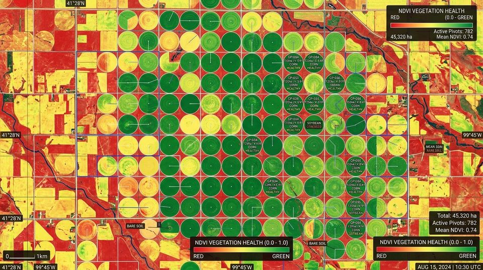
Mazowe Agro-Estate Crop Health Monitoring
Mazowe Valley, Mashonaland Central
Sentinel-2 and Planet imagery pipeline tracking vegetation stress (NDVI) and irrigation efficiency.
Technology & Geospatial
We apply machine learning to satellite, drone and document data so you can monitor land and assets without visiting every hectare.
Used in: Agriculture & agribusinessEnvironmental & natural resourcesNGOs & development organisations
Detect buildings, roads, fields and water from imagery.
Vegetation indices (such as NDVI) to spot stress and plan irrigation.
Compare dates to find new construction, encroachment or clearing.
Turn scanned land records into searchable data.
Results presented as maps, charts and regular reports.
You tell us the location, what you need and any deadline — by form, email, phone or WhatsApp. We ask what we need to know.
Where the work needs it, we visit or review the site, existing plans and records before pricing.
A written scope and quotation with dates. Every quotation carries a QR code you can check online.
Once you accept, we book people, equipment and materials and agree the programme with you.
Survey, mapping, software or building work is carried out, with progress, files and messages in your client portal.
Final deliverables, plans or keys, with the invoice and receipt kept together in one place.
Mazowe Valley, Mashonaland Central
Sentinel-2 and Planet imagery pipeline tracking vegetation stress (NDVI) and irrigation efficiency.
Drone photogrammetry and LiDAR for fast, detailed mapping of sites, estates and corridors.
View serviceWeb-GIS portals, dashboards and secure client portals for projects, documents and billing.
View serviceSpatial databases, analysis and clear maps built from survey, drone and satellite data.
View serviceSend the location and what you need. We reply with next steps and, where possible, a quotation.