UAV LiDARCompleted
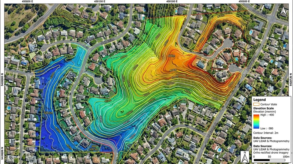
Borrowdale North Topographic LiDAR
Borrowdale, Harare
UAV photogrammetry and a digital terrain model for a residential development and its drainage masterplan.
Selected survey, land and technology work across Zimbabwe.
6 projects. Open one for photos and details, or see where we worked on the map.
Borrowdale, Harare
UAV photogrammetry and a digital terrain model for a residential development and its drainage masterplan.
Borrowdale, Harare
Boundary verification, beacon recovery and 3D terrain runoff analysis for a residential development.
Ruwa, Mashonaland East
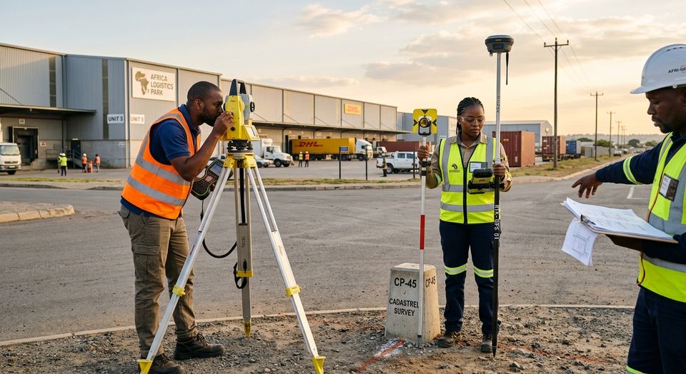
Statutory boundary survey, consolidation and beacon recovery for commercial logistics stands.
Mazowe Valley, Mashonaland Central
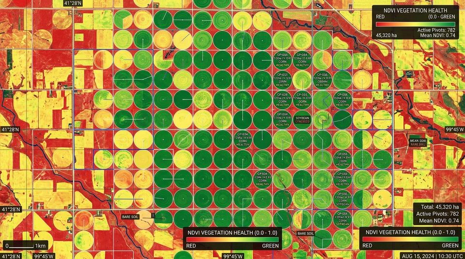
Sentinel-2 and Planet imagery pipeline tracking vegetation stress (NDVI) and irrigation efficiency.
Samora Machel Ave, Harare
Volumetric building models and utility-corridor mapping for municipal urban management.
Victoria Falls, Matabeleland North
Environmental sensitivity zoning and boundary demarcation for an eco-lodge development.
Send the location and what you need. We will tell you which survey, data or building work fits.
Based in Harare, we take on survey, mapping and building projects across Zimbabwe. Travel and accommodation outside Harare are included in the quotation.
Select a marker to see the survey details.
Boundary verification, beacon recovery and 3D terrain runoff analysis for a residential development.
| Location | Borrowdale, Harare |
| Service | Cadastre & Land Administration |
| Status | Title deed certified |
| Extent | 4,250 m² (0.425 ha) |
| Method | RTK GNSS + drone LiDAR |
| Accuracy | Sub-centimetre (< 15 mm) |
| Reference | ZW-HRE-2026-084 |
| Coordinates | -17.7412, 31.1120 |
Send the location and we will tell you which survey, data or building work fits.